|
2013 Lincoln/Lancaster County Nebraska Storm Spotters' Maps
and Quick Reference Guide
(this page contains a large graphic and may load slowly...have patience!)
Spotters' Quick Reference Card and Glossary
Adobe Acrobat pdf file -- 165 KB
Microsoft Word Version -- 91 KB
The Quick Reference Guide and Glossary present features and terms you should be familiar with while spotting. This spotting aid is NOT a substitute for training! It can, however, serve to remind you of what to look for, where to look for it, and what to call it...all of which are sometimes difficult to remember in the "heat of battle."
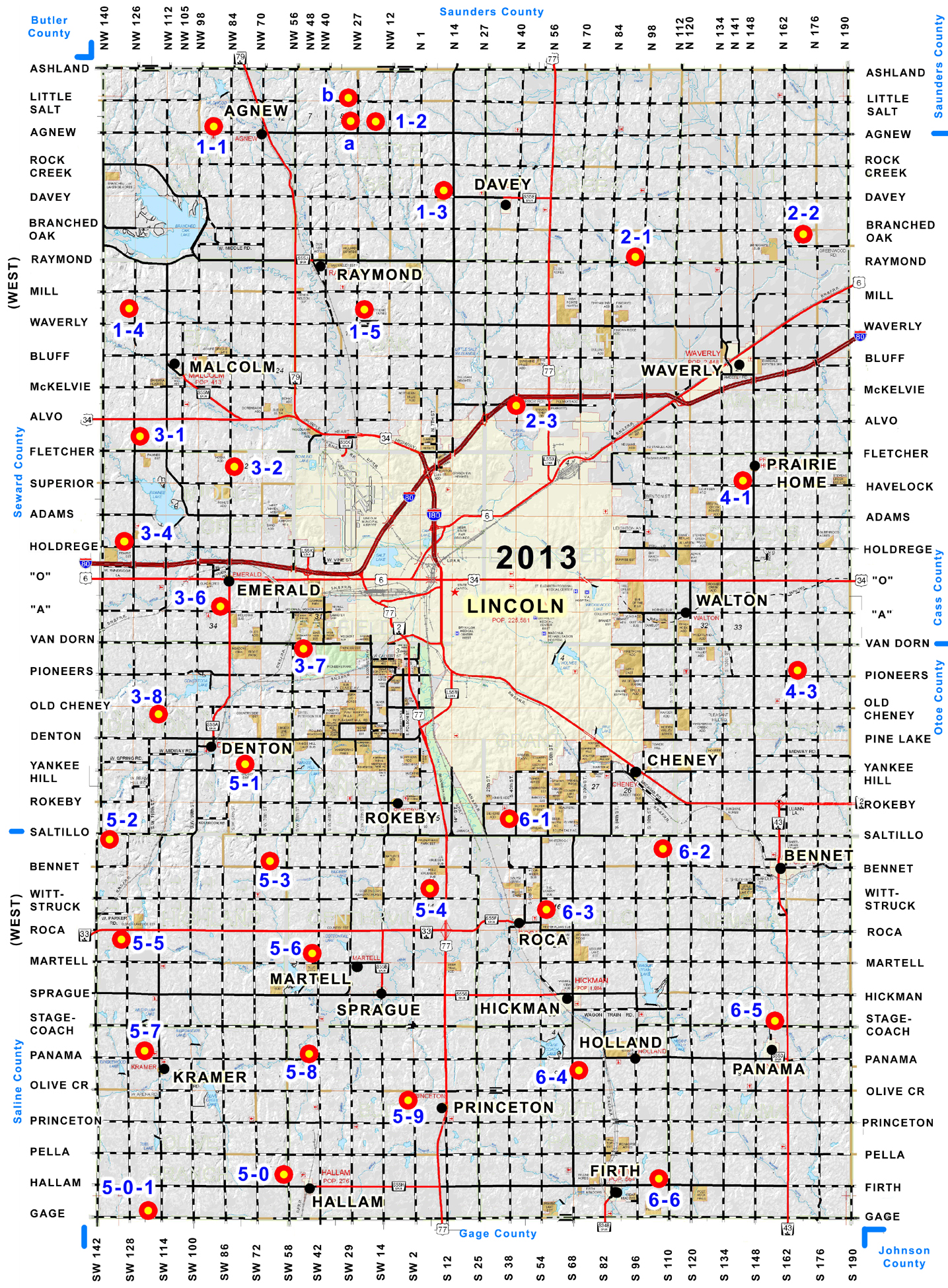
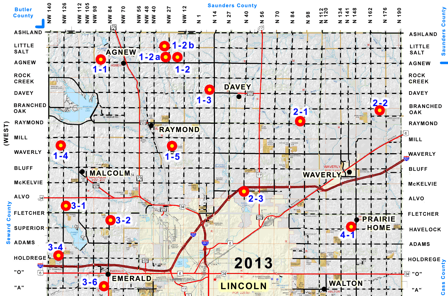
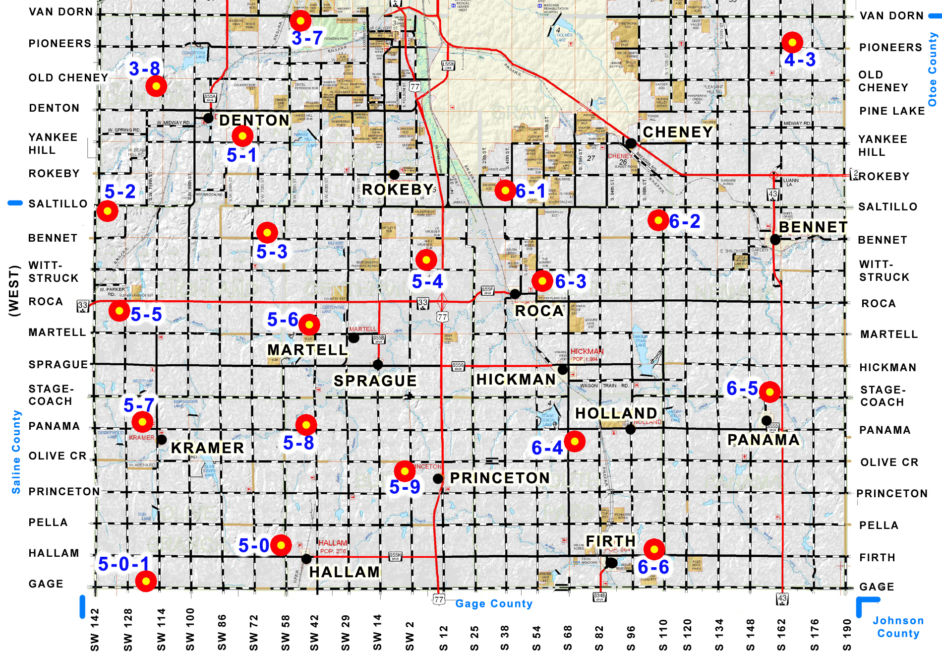
2013 Lancaster County Spotters' Maps
If you've been looking for something a little more colorful and detailed than the plain-label black and white Lancaster County Storm Spotters Map that is distributed at our annual storm spotter training, we've got some options for you. These maps are also available for download as high-resolution color JPEG images for printing. Right-click on the links and choose "save image as" or "save target as". If you left-click the links, be sure you maximize the image before saving or printing.
If you'd like the compact 8.5 X 11 version, download the following:
2013 Spotters' Map Single Page Image (2.7 MB, 200 dpi JPEG)
If you'd like the larger two-page version, download the following:
2013 Spotters' Map North (2.0 MB, 200 dpi JPEG)
and
2013 Spotters' Map South (2.0 MB, 200 dpi JPEG)
IMPORTANT! These maps are for informational purposes only. Please DO NOT go to these points during a severe weather event unless you are a trained weather spotter who has been officially assigned to that point by Emergency Management and net control. Additional vehicles, lights and people make storm spotting very difficult and put lives in jeopardy.
Maps and Spotters' Quick Reference Guides were compiled by Greg KTØK. Please contact me (below) corrections, questions or problems. Thanks
|